Site details
Tomb of Soroudi
| PK | C7770 |
| TITLE | Tomb of Soroudi |
| WGS84 | 36.930475° N, 24.737709° E |
| Accuracy | Exact |
| LAT/LON | 36.930475, 24.737709 |
| LON/LAT | 24.737709, 36.930475 |
| DMS | 36° 55' 49.71" N | , | 24° 44' 15.7524" E |
| W3W | mystify, saved, unspoiled |
| UTM | 35 S, 298512.44, 4089550.54 |
| EGSA87 | 565550, 4087126 |
| Elevation m | 88 |
| Elevation feet | 288.7 |
| Region | Cyclades |
| Subregion | Siphnos |
GENERAL SITE TYPE Tholos
TYPE
1. Tholos. BCH [2001], 986 ' ..., pourrait être une tombe à tholos.'PERIOD (High Chronology)
1. Late Helladic: (1700 BC - 1050 BC)
a. BCH [2001]: 986, ?? ' ..., pourrait être une tombe à tholos.'
NOTE
1. Details about this supposed tholos are a bit hard to come by. The photograph shows a two peaked structure which suggests a tholos whose center has collapsed. One is reminded of the remarks in Messenia III about Kamari Gouva (C173) which was also thought to be a collapsed tholos: " ... [the traveler] sees on the w skyline what appear to be two artificial mounds quite close together."
rhc
BIBLIOGRAPHY
1. BCH[2001](2): Bulletin de correspondance hellénique. Volume 125, part 2., 'Une grande construction située à Soroudi, ... ', pg. 986.
Online here.
2. Messenia III: McDonald, William A. and Richard Hope Simpson. ‘Further Explorations in Southwestern Peloponnese: 1964-1968’, American Journal of Archaeology. Vol. 73, No. 2 (Apr., 1969), pp. 123-177., '23D. Gouva (Kamari)', pg. 137.
Online here.
PHOTOS AND IMAGES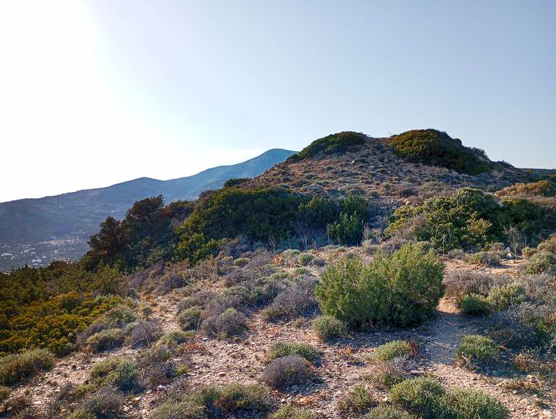
The probable tholos tomb of Soroudi, Sifnos.
The Mycenaean Atlas Project wishes to thank the Municipality of Sifnos (https://sifnos.gr/) for making this photo available. All rights retained by the Municipality of Sifnos.