Arkadiko Bridge
| PK | C867 |
| TITLE | Arkadiko Bridge |
| WGS84 | 37.593631° N, 22.937559° E |
| Accuracy | Exact |
| LAT/LON | 37.593631, 22.937559 |
| LON/LAT | 22.937559, 37.593631 |
| DMS | 37° 35' 37.0716" N | , | 22° 56' 15.2124" E |
| W3W | servicer, burgers, stirrer |
| UTM | 34 S, 671055, 4162494 |
| EGSA87 | 406058, 4160972 |
| Elevation m | 200 |
| Elevation feet | 656.2 |
| Region | Argolid |
GENERAL SITE TYPE Bridge
TYPE
1. Bridge. Simpson and Hagel [2006], 158 'The 'Arkadiko' bridge is of typical 'Cyclopean' construction, employing the customary Mycenaean arch, ... '2. Bridge. Ålin [1962], 51 'Die sich hier befindende Steinbrücke soll ebenso aus mykenischer Zeit stammen.'
3. Bridge. Simpson [1981], 27 ' ... the famous "Arkadiko" bridge ... This is of the typical "Cyclopean" construction, employing the Mycenaean arch, ... '
4. Bridge. Simpson and Dickinson [1979], 51 'The "Arkadiko Bridge" in Cyclopean style c. 700 m. to the W, on the left of the road from Nafplion, ... '
PERIOD (High Chronology)
1. Late Helladic: (1700 BC - 1050 BC)
a. Simpson [1981]: 27, Probably after 1300.
b. Ålin [1962]: 51, ' ... mykenischer Zeit ... '
c. Simpson and Dickinson [1979]: 51, ' ... surely part of the LH road network in the Argolid.'
d. Simpson and Hagel [2006]: 158,
NOTE
1. Dimensions of the bridge are given in Simpson and Hagel [2006] 158 and see fig. 8 for a section sketch along with measurements.
rhc
BIBLIOGRAPHY
1. Ålin [1962]: Ålin, Per. Das Ende der mykenischen Fundstätten auf dem griechischen Festland. Carl Bloms Boktryckeri A.-B., Lund, 1962., 'Kasarma', pg. 51.
2. Simpson and Hagel [2006]: Simpson, R. Hope and D.K. Hagel. Mycenaean Fortifications, Highways, Dams and Canals. SIMA vol. 133. Paul Åströms Förlag. Sävedalen, Sweden. 2006., 'II The Highway between Tiryns and Epidauros', pg. 158.
3. Simpson [1981]: Simpson, Richard Hope. Mycenaean Greece. Park Ridge, New Jersey: Noyes Press, 1981., 'A 28 Ayios Ioannis: Kasarma', pg. 27.
Online here.
4. Simpson and Dickinson [1979]: Simpson, Richard Hope and O.T.P.K. Dickinson. A Gazetteer of Aegean Civilization in the Bronze Age, Vol. I: The Mainland and the Islands. Paul Åströms Förlag, Goteborg. 1979., 'A 25 Ayios Ioannis: Kazarma', pg. 51.
Online here.
PHOTOS AND IMAGES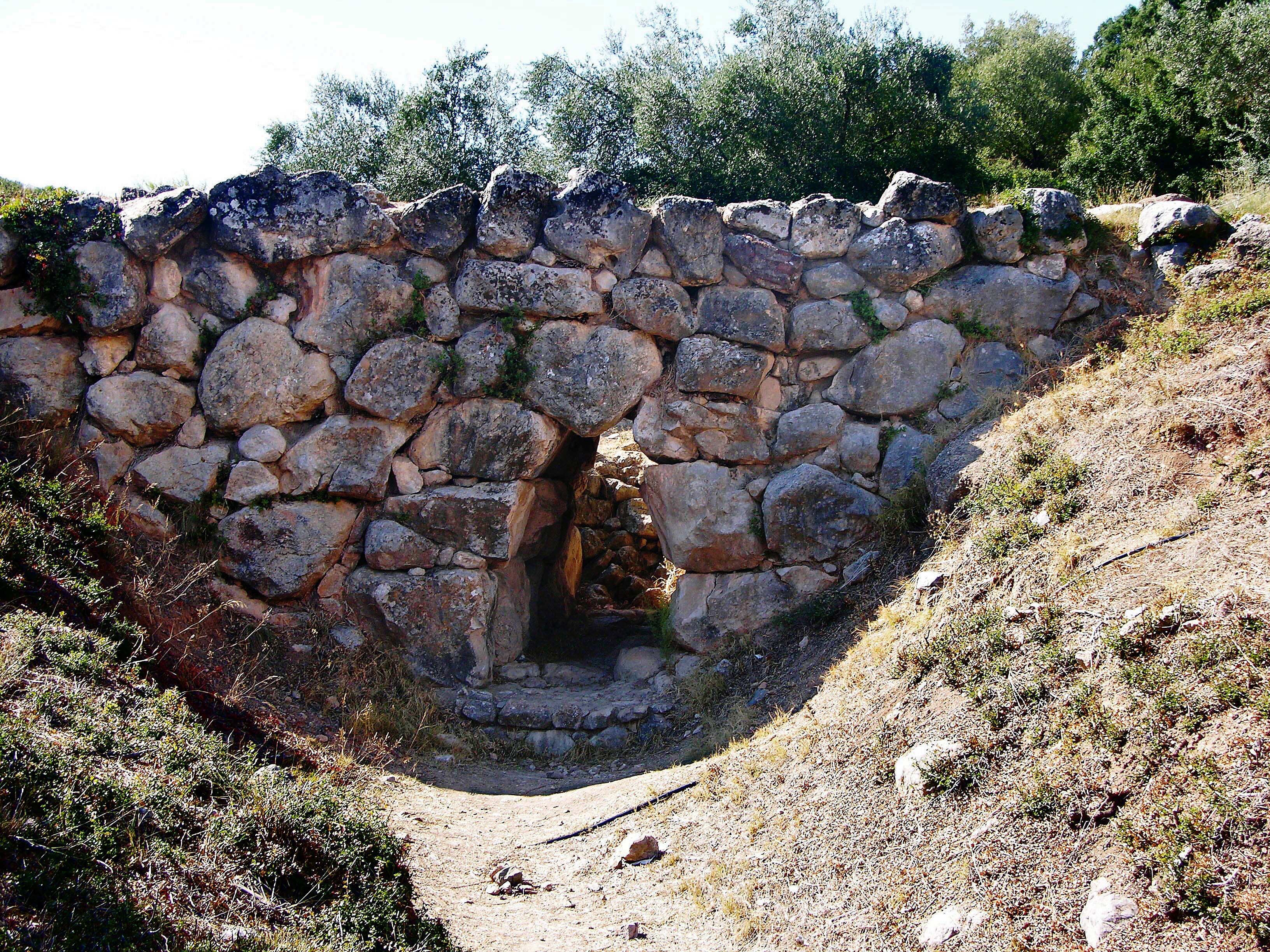
Arkadiko Bridge
Dr. Hajo Becker asserts his rights to this photograph under Attribution-ShareAlike 4.0 International (CC BY-SA 4.0).